WGTN-Sculptures
Wellington Sculpture Map
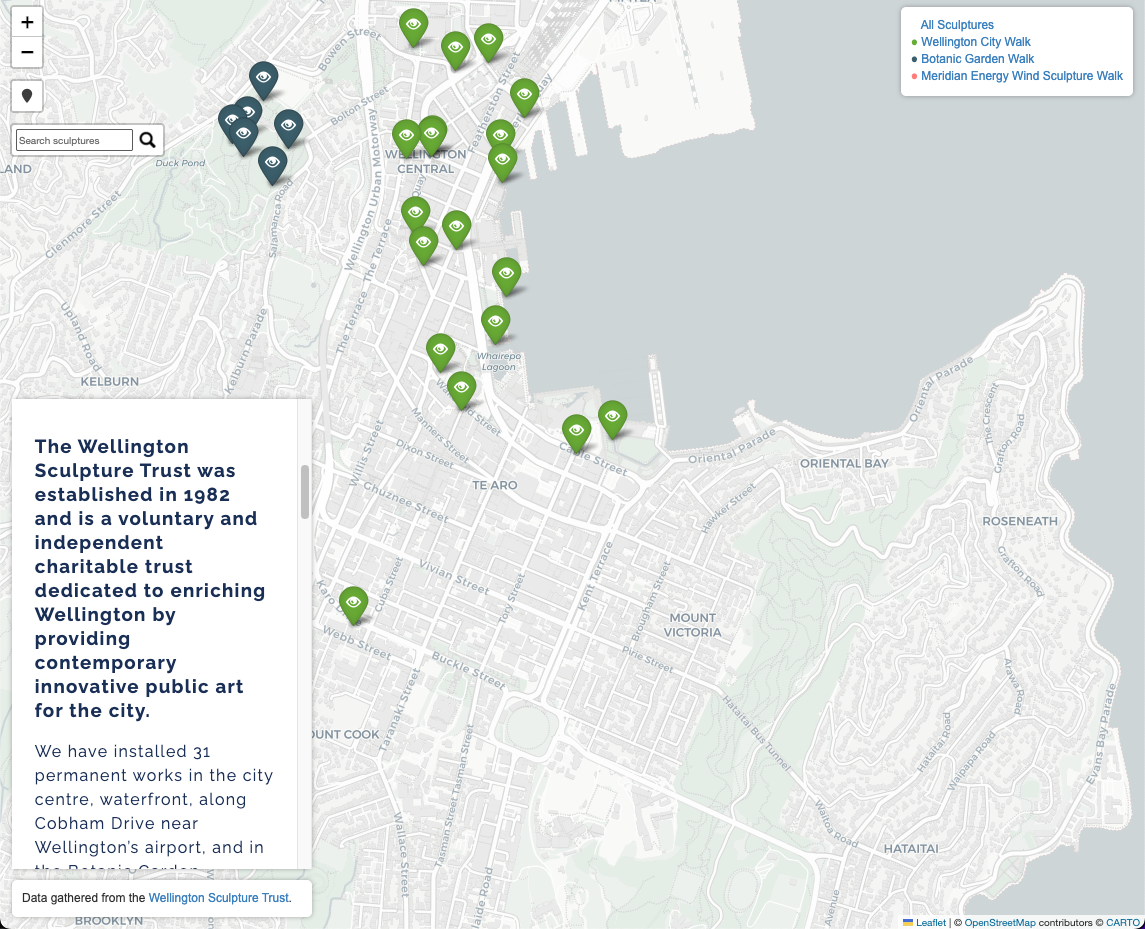
This project is an interactive map of public sculptures in Wellington, New Zealand. The dataset is based on the Wellington Sculpture Trust’s collection, and was created using information available on the WST’s website. Users can view a representation of each sculpture’s geographic location, and can click on each marker to view information about that sculpture (title, artist, description, image, etc). Users can also organize by collection (Wellington City Walk, Botanic Garden Walk, etc) and view the suggested walking route for viewing that group of sculptures. There’s also a live location feature, search feature, a navigation tab for the website’s four pages, and a general information panel in the bottom left (iFrame of the Wellington Sculpture Trust Website).
Objectives
- Present geographic information about the WST’s collection in an engaging and geographically useful way.
- Provide a tool that can be used for self-guided tours (track location + provide route and sculpture information).
- Create a strong GIS (Geographic Information System) portfolio piece by demonstrating in-demand skills.
Tech Stack
Languages & Libraries:
- Python + Folium, Pandas, & Pytest Libraries
- JavaScript
- HTML
- CSS
Software & Services:
- Google Sheets
- geojson.io
- Github (Version Control) + Github Pages (deployment)
How to Run
- Run WGTN_sculptures.py.
- Place the html files that were generated along with script.js into the same folder.
- Open index.html with a web browser.
You can also view the website online at: https://cpbarrett9.github.io/wellington-sculpture-map/.